
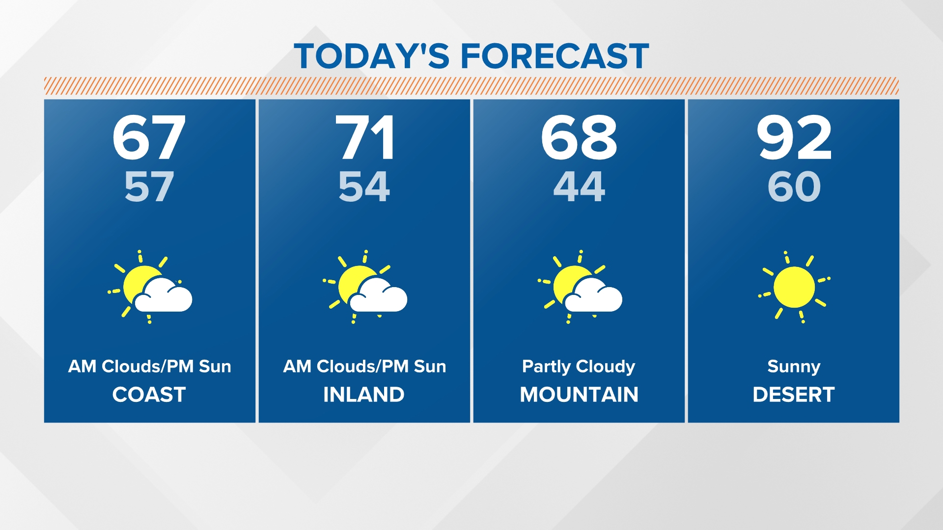
SAN DIEGO — The daily afternoon sunshine will be on tap yet again Wednesday following an overcast start to the day. The marine layer stretched farther east this a.m. compared to most of the past mornings this week. This suggests we could be waiting slightly longer, until closer to 10:00 or 11:00 a.m. to see the sunshine prevail. Temperatures will remain near normal by the afternoon with highs mostly in the upper 60s and low 70s. Fewer clouds will join us to start Thursday and Friday as onshore winds weaken.


We've been basking in the sunshine lately. This beautiful weather is sticking into the start of May. The marine layer has been shallow and burning off quickly over the last few days. As onshore flow picks up from sweeping lows, expect the marine layer to deepen and linger a little longer tomorrow morning with more afternoon sunshine to follow. The push of cooler air will also bring a minor slip in temperatures on Wednesday with low 70s peaking inland as daytime highs stay in the 60s along the coast.
WEDNESDAY TEMPERATURES:

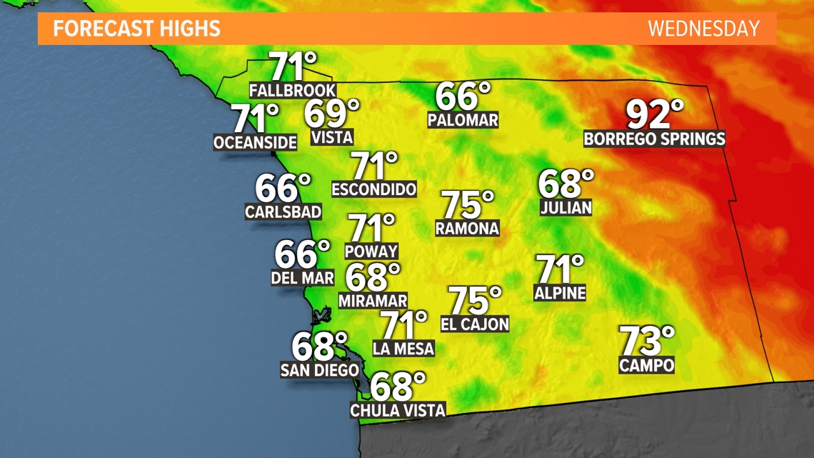
AT THE COAST:
The surf will remain elevated through the middle of the week. Expect the surf to be 3 to 6 feet with a high risk of rip currents through Wednesday. Surf heights will subside on to 2 to 4 feet with a moderate risk of rip currents on Thursday.


Weak Santa Ana winds will develop which could push temperatures 5 to 10 degrees above average Thursday and Friday. The wind gusts will peak up to 25 - 35 mph. Some coastal cities will peak in the low 70s with low 80s across the inland valleys.
On those days, expect patchy cloud cover close to the coast. The marine layer will retreat back to the coast as opposed to stretching to the coastal mountain slopes like Wednesday morning. This will lead to the return of patchy low clouds and fog along the coast.
The marine layer will deepen a little more over the weekend as a low pressure system sweeps through the Pacific Northwest. The latest model runs show it sagging a little more to the south. Therefore, our chances have increased for a slight to a chance Saturday night through Sunday. Cooler temperatures and gusty west winds will also pick up with a more pronounced dip in degrees inland from Saturday to Sunday.


Stay current on the microclimate forecast by downloading the CBS 8 app on your cell phone and the CBS 8+ app on Roku and Amazon Fire TV. There you’ll find all our newscasts, specials, the latest weather forecasts, breaking news, and much more.


HERE ARE MORE WAYS TO GET CBS 8:
ADD THE CBS8+ APP TO YOUR STREAMING DEVICE Roku | Amazon Fire